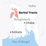
Everywhere else in Bangladesh, the land gives up and lies flat. Bandarban is where it refuses to. In the far south-east of the Chittagong Hill Tracts, ridge rises behind ridge towards the Myanmar border, the roads climb in switchbacks through bamboo and teak, and on a clear winter morning the valleys fill with cloud until only the highest villages stand above it. This is the most mountainous district in the country and, at the same time, its least populated: some 4,479 square kilometres of hill forest holding barely 481,106 people at the 2022 census. It is the land of the country's highest ground, its most famous hill lake, its largest Buddhist temple — and of peoples who were living in these hills centuries before the district had a name.
Bandarban is also a district that travel writing tends to oversell. Its peaks carry heights their summits never had, its lake is routinely placed far above its real elevation, and for almost three years much of it was simply closed. This profile tries to do the place the respect of accuracy: the land and its river, the peoples who share it, the high places as they actually measure, and the state of the district as of November 2026 — reopening, cautiously, after a long security closure.
The land and the Sangu river
Bandarban became a separate district in 1981 and is administered in seven upazilas: Bandarban Sadar, Ruma, Thanchi, Rowangchhari, Lama, Alikadam and Naikhongchhari. But administration is a thin layer here. What organises the district is topography — long parallel ranges running roughly north-west to south-east, cut by steep valleys — and one river above all.
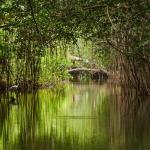
The Sangu rises in the North Arakan Hills of Myanmar and enters Bangladesh near Remakri in Thanchi upazila. Against the usual logic of rivers, it first flows north, winding through Thanchi, Rowangchhari and Bandarban Sadar, before bending west through the Chittagong foothills to meet the Bay of Bengal near Khankhanabad. Its length is itself a small lesson in the region's documentation: Banglapedia gives 295 kilometres, Wikipedia 270, of which about 173 kilometres lie inside Bangladesh. Bandarban town stands on its bank, and for the villages beyond the roadheads the Sangu remains the real highway — the boat journey upriver from Thanchi to Remakri, between cliffs and bamboo groves, is one of the great river trips of Bangladesh. The river is two different creatures by season: shallow, clear and strewn with boulders in winter, a fast brown flood in the monsoon that can cut the southern upazilas off for days.
Around the river, the hills carry what is left of the region's forests — evergreen and semi-evergreen woodland, bamboo brakes, teak plantations and the patchwork of jhum clearings. The dry season runs roughly from November to March, and it is in those cool, clear months that Bandarban shows itself best.
The people of Bandarban
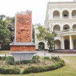
According to the 2022 census, Bengalis form a majority of the district's population — 283,123 people, or 58.85 per cent. The remaining 41.15 per cent, just under 198,000 people, belong to the Indigenous peoples of the hills, collectively the Jumma peoples of the Chittagong Hill Tracts. Bandarban town is also the seat of the Bohmong Circle, one of the tracts' three hereditary chiefdoms; the Bohmong raja's palace still stands in the town, a reminder that the hills were governed through their own chiefs long before district commissioners arrived.
The largest Indigenous community is the Marma (84,170 in 2022), descendants of Arakanese who crossed from what is now Myanmar over several centuries. The Marma are Theravada Buddhists — their monasteries, called kyang, anchor villages across the district — and they speak a language closely related to Rakhine and weave fine cloth. Next come the Mro (51,448), among the oldest inhabitants of these hills, who live in small villages on high ridges, many following their own Krama faith, their isolation keeping their language and dress distinct. The Bawm (11,854, also spelled Bom) are concentrated around Ruma and Boga Lake; converted by missionaries in the early twentieth century, they are today largely Christian, and they run many of the cottages and guide services on the Boga Lake trail. Around them live the Tripura (22,572), the Tanchangya (14,889), a small Chakma population (3,712 — the Chakma heartland lies further north), and the smaller Khumi, Chak and Khyang communities of the remote east, each with its own language.
What unites these different peoples is a way of farming the hills: jhum, shifting cultivation, in which a slope is cleared, burned, cropped for a season or two with a mixture of rice, vegetables, cotton and spices, and then left fallow to recover. Jhum is visible from every road in Bandarban — and it is under pressure, as fallow periods shorten. Beside it, valley wet-rice, orchards of banana, papaya and mango, and increasingly tourism, make up the district's livelihoods.
The high places: Nilgiri, Chimbuk and the road south
The classic excursion from Bandarban town runs south on the hill road to Thanchi, and its two famous stops are viewpoints rather than summits. Chimbuk, about 26 kilometres out, is a roadside ridge commonly cited at about 2,500 feet, with Mro villages nearby and a celebrated view over the Sangu valley. It is often called the third highest mountain in Bangladesh; it is not — no modern measurement supports the claim — but as a place to watch cloud pour through the ranges at dawn it needs no borrowed rank. Further on, at about 46 to 50 kilometres, stands Nilgiri, an army-run tourist spot at roughly 2,200 feet (tourism brochures sometimes claim 3,500 feet for it, which the summit does not possess). Nilgiri's gift is not altitude but position: the ranges fall away on every side, and in the winter months visitors sleep in cottages above a sea of morning cloud. Closer to town, Nilachal, about five kilometres away at Tigerpara and roughly 2,000 feet up, gives the sunset view over Bandarban itself, and the Meghla tourist complex spreads around a small lake by the town gate.
Boga Lake: the lake on the roof of Ruma
East of the roadheads lies the place that has come to symbolise the whole district. Boga Lake — Bagakain Lake — sits about 18 kilometres beyond Ruma town: some 15 acres of still, deep water held in a bowl of forested hills, at about 1,246 feet above the sea. Local publicity often lifts it to 3,000 feet; the lower, surveyed figure needs no help, because the lake's real distinction is its atmosphere. The water is dark and glassy, dragonflies work the lilies, and on its shore stands a village of the Bawm people, whose families host the travellers who make the journey.
Nobody knows exactly how Boga Lake came to be. Geologists who surveyed it in 1973 left the question open, and the theories on record include a meteor crater, volcanic action and a collapsed slope. The Khumi people of the area have an older explanation: that a village once stood where the lake lies, and that after its people killed and ate a deity who had come to them in the form of a great serpent, the earth shook and swallowed the village whole, and the water rose over it. The story is told to this day, and it shaped behaviour — local people long treated the lake as a place of spirits and did not swim in it. Travellers reach Boga Lake by jeep to Ruma, registration at the army checkpoint, and then a climb on foot or by local vehicle; it is the natural base for the trail onward to Keokradong.
The peaks question: which is the highest point in Bangladesh?
Ask a simple question in Bandarban and you will receive three answers. The popular one is Keokradong, the great trekking peak of Ruma upazila, long taught in textbooks and proclaimed on signboards as the highest point in Bangladesh at 1,230 metres (4,035 feet). That figure is simply wrong. Banglapedia — which repeated it for years — now states plainly that the 1,230-metre claim is "a mistaken information that still features in respected sources". Measured properly, Keokradong is much lower: a GPS team recorded 986 metres (3,235 feet), a Garmin reading gave 974 metres, and the army's own signboard on the summit concedes 967 metres. There is even disagreement about which summit the name belongs to, since American and Russian mapping place a Keokradong of 883 metres further north. None of this diminishes the mountain: the climb from Boga Lake through Bawm and Mro villages to its bare, windy summit remains the finest walk in Bangladesh. It is just not the roof of the country.
The official answer is Tazing Dong, also spelled Tahjindong and known as Bijoy, in Thanchi upazila, which government sources recognise as the highest mountain in Bangladesh at a claimed 1,280 metres (4,200 feet). The recognition is real; the number is not verified — independent GPS surveys have never confirmed 1,280 metres, and mountaineers treat the figure with open scepticism. The third answer is the one the instruments give. On a remote summit of the Mowdok range, hard against the Myanmar border, English adventurer Ginge Fullen recorded 1,064 metres by GPS in February 2006; satellite (SRTM) data and Russian topographic maps put the same summit at about 1,052 metres, and two Bangladeshi trekking clubs later measured 3,488 and 3,461 feet there. The peak has no official name — locally, the Tripura people call it Saka Haphong. On the best available measurements it is the highest ground in Bangladesh, and it holds that title unofficially, unmarked and almost unvisited, while the argument continues below it.
Town and temple: Bandarban and the Golden Temple
Bandarban town itself is a small, likeable hill settlement strung along the Sangu: a bazaar, the Bohmong raja's palace, the boat ghat, and a ring of viewpoints. Its outstanding monument stands a few kilometres out at Balaghata. The Buddha Dhatu Jadi, known to everyone as the Golden Temple, is the largest Theravada Buddhist temple in Bangladesh and holds the country's second-largest Buddha statue. It was founded by Venerable U Pannya Jota Mahathera, a monk of the Bohmong royal family who had earlier served the state as a senior assistant judge, and built between 1995 and 2000 in the Arakanese style — gilded tiers, bell-shaped finials and maroon-and-gold detail on a hill some 60 metres high. The temple's name carries its purpose: a dhatu is a relic of the Buddha, and the shrine enshrines a relic gifted from Myanmar, beside a hilltop pond called Debota Pukur, the pond of the god. It is a working monastery, not a museum, and it draws Buddhist pilgrims from across the country as well as the merely curious. The temple's own history has not been entirely smooth — it was closed for about nine months in 2016, amid a dispute involving its administration — but it has long since reopened, and on festival days its courtyard is a centre of Marma Buddhist life.
The trekking economy and its pressures
From the 1990s, Bandarban converted its scenery into an economy. Registered guides — organised in associations such as the Ruma Tourist Guide Welfare Association — lead the trails; syndicates of jeeps, the open chander gari, work the hill roads; Bawm families at Boga Lake and villagers along the Keokradong trail turned their homes into cottages and kitchens; hotels and restaurants multiplied in the town. For hundreds of hill families, a winter of trekkers came to pay better than a hillside of jhum.
The pressures grew with the trade. The best-known sites collect plastic and building sprawl faster than anyone collects them up; hilltop villages that host visitors face dry-season water scarcity; and a new road pushed towards Keokradong — vehicles can now drive most of the way to the peak — has changed a three-day trek into a day trip, with all that implies for the villages that once fed and housed the walkers. But the sharpest pressure of all was not environmental. It was security, and between 2022 and 2025 it simply stopped the industry.
Bandarban today
The facts, as of November 2026, are these. In late October 2022, amid joint security operations against the Kuki-Chin National Front (KNF) and the militant group Jamaatul Ansar Fil Hindal Sharqiya, the district administration suspended tourist travel to Keokradong and to parts of Ruma, Thanchi, Rowangchhari and Alikadam. The closure lasted, in stages, for almost three years; an army operation as late as July–August 2025 uncovered a Kuki-Chin training camp in Ruma's Reng Tlang area, a sign of how live the situation remained. Reopening, when it came, was equally staged. Restrictions on Boga Lake, Tindu and Tamajhiri were lifted on 6 June 2025, and on 1 October 2025 the Deputy Commissioner lifted the ban on Keokradong itself by public notice — visitors may travel only to officially reopened destinations, must register at the checkpoints, and must be accompanied by a registered guide; the notice warns that restrictions can return after any incident. The winter season of 2025–26 was the trekking economy's first full test since the closure, and the current 2026–27 season is its second.
Some doors remain shut. The river route beyond Tindu to Remakri and the Nafakhum waterfall, among the most loved journeys in the hills, is still closed to tourists; the administration said in September 2025 that reopening was under consideration, and as of August 2026 travellers were still permitted only as far as Tindu. In November 2025 a tourist who entered the Nafakhum area without registering or hiring a guide went missing there — a stark illustration of why the rules exist. Foreign visitors face an additional layer: prior permission for travel in the Hill Tracts, arranged through the district administration or a registered operator with roughly ten days' notice under current foreign-government advice, and the British Foreign Office advises against all but essential travel to the district. Bandarban town, the Golden Temple, Nilachal and the road to Nilgiri have remained open throughout. Travellers should confirm the current position with the district administration or a registered local guide before going beyond the town, because in these hills the position can change without notice — as the experience of Sajek Valley, the region's other celebrated ridge, closed in the autumn of 2026, has shown once again.
None of this erases what Bandarban is. It remains the one district of Bangladesh where the horizon is made of mountains, where a Buddhist temple of gold stands over a river town, where eleven peoples farm the ridges as their ancestors did, and where the highest ground in the country waits, still arguing about its own name. The district asks more of its visitors than any other in Bangladesh — permits, guides, patience, and honesty about heights. It repays all of it.