One river crosses Asia under four names. It begins as a glacier stream near Mount Kailash in Tibet, runs east for more than a thousand kilometres as the Yarlung Tsangpo, the Purifier, cuts through the deepest gorge on earth at the Himalaya's eastern end, descends into India as the Siang and the Brahmaputra, the Son of Brahma, and enters Bangladesh to become the Jamuna: a braided giant up to thirteen kilometres wide, carrying more water than almost any river on the planet and enough silt to build a delta. For Bangladesh the Brahmaputra is not scenery. It is the country's largest river, the maker of its northern plains, the destroyer of farms and villages by erosion, the creator of new land by deposition, and, in the great flood of 1787, the author of one of the most dramatic course changes any major river has made in recorded history.
Brahmaputra River at a Glance
- Length: about 2,900 kilometres in total; about 276 kilometres within Bangladesh, of which the Jamuna proper is about 205 kilometres
- Source: glaciers near Lake Manasarovar and Mount Kailash in south-western Tibet, at about 5,300 metres
- Names: Yarlung Tsangpo in Tibet; Siang or Dihang in Arunachal Pradesh; Brahmaputra in Assam; Jamuna in Bangladesh
- Basin: about 583,000 square kilometres across China, India, Bhutan and Bangladesh, only about 47,000 of them inside Bangladesh
- Flow: average discharge at Bahadurabad about 20,000 cubic metres a second; monsoon flows average about 40,000, and the record flood of August 1988 reached 98,600
- Sediment: about 735 million tonnes a year at Bahadurabad, among the highest loads of any river in the world
- Mouth: joins the Ganges (Padma) at Goalundo; the combined waters meet the Meghna at Chandpur and reach the Bay of Bengal
From Tibet Through the Great Gorge
The river rises on the glaciers south of Lake Manasarovar, in the sacred geography where Asia's great rivers begin, and flows east along the seam between the Himalaya and the Kailas range as the Yarlung Tsangpo, receiving the Lhasa River below Tibet's capital. For centuries Europeans did not know where this river went; only in 1884 to 1886 was the Tsangpo proved to be the Brahmaputra. The answer lay at the river's Great Bend, where it turns sharply around the peak of Namcha Barwa and plunges through the Yarlung Tsangpo Grand Canyon, in places more than 5,000 metres deep, among the deepest gorges on earth, before falling from the plateau to the plains of Arunachal Pradesh as the Siang, or Dihang. Joined by the Dibang and the Lohit, it enters the Assam valley as the Brahmaputra proper and runs some 700 kilometres south-west, already a braided, island-strewn river miles wide in the rains, gathering the Subansiri, the Kameng, the Manas and dozens of other Himalayan tributaries. Below Dhubri it bends south around the Garo Hills and crosses into Bangladesh.
Becoming the Jamuna
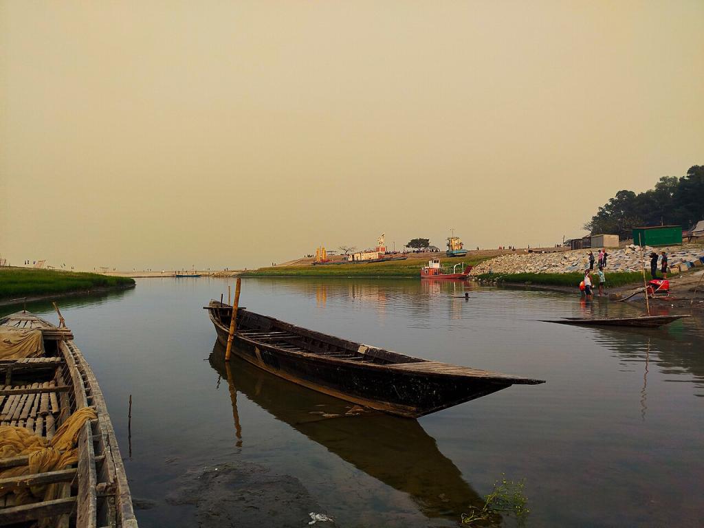
Inside Bangladesh the river is the Brahmaputra-Jamuna, and its character is scale. At Bahadurabad, where its flow is gauged, it carries on average about 20,000 cubic metres of water a second, ranking by discharge with the world's greatest rivers; in the monsoon the average doubles, and in the flood of August 1988 it peaked at 98,600 cubic metres a second. The Jamuna is seldom narrower than three to five kilometres even in the dry season, and in the rains it spreads eight to thirteen kilometres from bank to bank, a moving inland sea split into interlacing channels around sand islands. Its right bank receives the Dudhkumar, the Dharla and above all the Teesta, the great north Bengal river whose own story is bound up with the Jamuna's birth. Near Goalundo the Jamuna meets the Ganges, called the Padma in Bangladesh, and the combined river flows on as the Padma to Chandpur, where it joins the Meghna and takes that name to the sea. Even their meeting point will not stay still: the Jamuna-Padma confluence migrated more than fourteen kilometres south-east between 1972 and 2014.
The Great Change of Course
The Jamuna is, in geological terms, a young river, and Bangladeshis live on the evidence. Until the late eighteenth century the Brahmaputra flowed not down the present Jamuna channel but south-east along what is now the Old Brahmaputra, past Mymensingh, to join the Meghna. In 1787 an exceptional flood year, remembered in the river's history as its turning point, the Teesta was diverted from its old course toward the Ganges and threw its waters east into the Brahmaputra system, and over the following decades, helped by the uplift of the Madhupur tract, the main Brahmaputra abandoned its old bed and cut the new channel it still follows: the Jamuna. The Old Brahmaputra survives as a modest, silting river on the Mymensingh reach, a shadow of the giant it once carried. No other event shows so plainly the truth the delta teaches everywhere: in Bangladesh the rivers are not fixed features of the land. They are processes, and the land is their temporary result.
A Braided River and Its Chars
The Jamuna is the textbook case of a braided river: a network of channels dividing and rejoining around bars of its own sediment. Those bars, the chars, are the river's most human feature. A dry-season survey of the Jamuna counted 56 large island chars, each more than three and a half kilometres long, and hundreds of smaller ones. Chars are born underwater, rise into farmland, support villages of some of the country's poorest people, who farm the silt, graze cattle and fish the channels, and then, in a bad flood year, dissolve back into the current, taking houses, mosques and schoolrooms with them. Bank erosion along the Jamuna displaces families every year, and the breaking of one char and the emergence of another has been a standing cause of dispute and litigation between the districts the river separates. The river also feeds what it threatens: its annual load of some 735 million tonnes of silt, over a million tonnes a day in the monsoon, is the raw material from which the Bengal delta, the largest on earth, continues to be built at the coast, land rising from the sea even as other land is eaten inland.
Crossings and the River Today
For most of history the Jamuna divided Bangladesh as much as it watered it: the east and the north-west were separate worlds joined by ferries. The Jamuna Bridge, opened in 1998 and for years the country's longest, carried road and rail across its 4.8 kilometres and stitched the two halves of the country together; it remains the measure of the river's width in the public mind. The river's future is now argued over at both ends of its course. In July 2025 China began construction of a vast hydropower project at the Great Bend of the Yarlung Tsangpo, five cascade stations with a planned capacity of about 60 gigawatts, the largest dam project ever undertaken, whose effects on the river's flow and sediment are watched anxiously downstream in India and Bangladesh, through which almost all the river's water must pass but which control almost none of its basin. At home, the questions are older and nearer: how to protect Sirajganj and the other eroding towns, how to govern the chars and the people on them, and how a country built by this river lives with a river that has never once stayed where it was put.
Sources
Encyclopaedia Britannica and Banglapedia on the Brahmaputra and Jamuna rivers (course, lengths, discharge and sediment figures); Wikipedia on the Jamuna River for char counts and the confluence migration study; published reporting on the Yarlung Tsangpo hydropower project begun in July 2025.